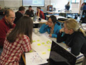
Graduate students often enter marine sciences with disparate backgrounds and experiences. Understanding biological oceanography, because of multiple interactions among organisms and with the environment, can be daunting to new graduate students. We use concept mapping as a tool to allow students to better integrate information and turn it into knowledge by explicitly visualizing ideas. Concept maps are graphic tools for visualizing and organizing ideas and processes, and for displaying relationships among concepts using connecting lines and descriptive phrases. We use a tool, the Concept Map Builder developed by COSEE Ocean Systems, to allow a student to create and share a map with other students. Each student registers an individual profile, creates a map, and sends the map to the class account where it is viewable by each student.
At the University of Maine, students in the biological oceanography course build four concept maps during the semester - on phytoplankton, bacteria (including Archaea), zooplankton and benthos. After each set of maps are completed, 25% of the students will guide the class through their maps, explaining their rationale for why they presented information in a specific way or made specific connections. At the end of the semester, students create a unified map, visualizing connections in the plankton and benthos. An individual student’s map serves as the basis for the one-hour oral final examination.
Evaluation results from this pilot test will lay the groundwork for a new initiative: "Linking Researchers and Graduate Students through COSEE Tools & Services". The COSEE Centers behind this proposal - California, Networked Ocean World (NOW), Ocean Systems and West -- will team ocean researchers and graduate students to co-create interactive concept maps and thereby improve their abilities to meet NSF "Broader Impacts" criterion. This model is based on results from the COSEE NOW "Annual Scientist Survey" (Word Craft, 2008) that cites scientists' "lack of time" as the greatest barrier to becoming involved in education/outreach and also clearly shows graduate students' comfort with using the latest online technology. The teaming of these audiences to create web-based ocean-climate products will tap into the scientific expertise of the researchers and the technical capabilities of the graduate students. The proposed project will test the time-efficiency and effectiveness of using concept maps to capture participants' views of ocean-climate connections. Moreover, the resulting products will be featured on the COSEE-OS website and accessible to other scientists, graduate students, educators, and the public.
This paper was written by Mary Jane Perry and Annette deCharon and presented at the 2010 Ocean Sciences Meeting in Portland, OR.
|


