Center For Ocean Sciences Education Excellence COSEE Ocean Systems
Follow this link to skip to the main content
HOME ABOUT US PROGRAMS EVENTS TOOLS NEWS CLIMB RESOURCES DIRECTORY CONTACT US
SEARCH RESOURCES
RESOURCES
 
FILTER RESOURCES
  • Select a category:
  • Select a resource type:
  • Search resources:
  • Order by:
 
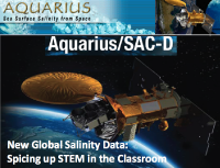
NASA Aquarius New Global Salinity Data: Spicing up STEM in the Classroom
 Cover of PPT presentation

Want to make salinity and its connections to the water cycle, ocean circulation and climate come alive for your students?

June 2011 marked the launch of NASA's first space-based measurements of ocean salinity across the globe - an important observation for ocean and climate studies. From 650 kilometers (400 miles) above Earth's surface, the Aquarius satellite detects changes in ocean salinity as small as a "pinch" of salt in a gallon of water. NASA Aquarius Education and Public Outreach has teamed up with COSEE-OS to conduct three public and four educator-focused webinars, as well as a pre-launch workshop at NASA Jet Propulsion Laboratory. Using resource-rich concept maps that help deconstruct complex STEM concepts, world-class ocean scientists and engineers have shared exciting stories about the technological development of the mission, and the first “hot from space” global salinity datasets - already reshaping our understanding of ocean salinity processes.

This session will showcase archived materials from webinars (maps, videos, images) along with educator- and scientist-vetted activities and datasets. See why 95% of educators from past events agreed they can “immediately apply what I learned to my teaching about science, technology or mathematics.” Come see salt in action!

Animations

Animation image 
Aquarius Monthly Means: Animation showing 4 months (Sept-Oct 2011), with close-up on the Atlantic Ocean to view the Amazon and Orinoco River freshwater input [Watch Now]

Animation image 
Density Effects: Dr Susan Lozier from Duke University explains why salinity is an important factor in driving ocean circulation [Watch Now]

Animation image 
SSS Globe: Global animation of sea surface salinity created from pre-Aquarius theoretical models [Watch Now]

Animation image 
Thermohaline Circulation: New global visualization including sea surface density overlay (at beginning) and deep sea topography underlay (throughout animation) - zooms to North Atlantic for close-up  of deep water formation region before panning across globe following flows [Watch Now]

Videos

Animation image 
Aquarius Engineering Perspective I (video clip from webinar): Speaker David Le Vine, Deputy Principal Investigator talks about the Aquarius instrument requiring a very specific orbit around Earth and orientation with respect to Earth and the Sun in order to collect accurate data on sea surface salinity and also run reliably on solar power. [Watch Now]

Animation image 
Aquarius Engineering Perspective II: (video clip from webinar): Speaker Gary Lagerloef, Principal Investigator talks about engineers designing the Aquarius instrument and satellite system to function well within the challenging space environment. [Watch Now]

Presented by: Christen M. Herren and Phoebe Jekielek (Ocean Systems)
2012 NSTA National Conference, Indianapolis, IN

DOWNLOAD (16.94 MB) >>
Back to Resources - Home