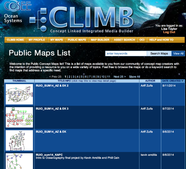
The public maps list is a collection of concept maps covering a variety of science topics that anyone can view, access and customize for their own educational purposes. These maps are submitted by our community of concept map creators and approved by COSEE-OS staff for release to the general public. Note: You do not have to log in to CLIMB to view our maps unless you want to save a copy to your profile. To view a list of currently available public maps, click on the Public Maps button on the gold menu bar at top of the page. The Public Maps list (see image at right) shows a thumbnail view of the concept map, map title, description, author, and date modified. Use your browser's scroll bars to scroll through the list. By default, 25 maps are shown per page, but you can view all maps on the same page (click Show All) or move to other pages using the <Previous 25 and Next 25> links. Note that map thumbnails may take a second to load (the waiting icons will be replaced with thumbnails once they are loaded). Click on the list's headers to sort the list alphabetically (in ascending or descending order) by map title or author's last name, or chronologically by map modification date. To view a map in the list, click on that map's title to open the Public Map Detail page. Previous | Next | Index |
