|
From Sailing Ships to Satellite: Studying Salinity Through A Sensor Web
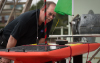
What is a sensor web, and how does it help SPURS? Dr. Eric Lindstrom takes us on a trip through salinity research,
revealing how ocean exploration has evolved over time. The SPURS team took part in an international collaborative
effort to better understand this fundamental part of the ocean and climate system, and used a combination of
approaches to investigate what's happening in the unique "ocean desert" of the North Atlantic.Webinar Archive
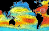
Concept Map: What is a Sensor Web and How Does it Help SPURS?
This concept map forms the basis of Dr. Lindstrom's presentation.
Hover over the concepts to uncover additional resources, or save this map to your own CLIMB
account by clicking on the light blue wrench in the upper left corner and selecting "Copy Map to My Maps".
Applicable Next Generation Science Standards
Dr. Eric Lindstrom is a Program Scientist in the Science Mission Directorate at NASA Headquarters in Washington D.C. He has degrees in Earth and Planetary Sciences from Massachusetts Institute of Technology (1977) and Physical Oceanography from the University of Washington (1983). His scientific interests include circulation of the ocean and air-sea exchange processes. Read more about Eric here.
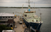
Seaglider #189 Away! [NASA Earth Observatory] The Seagliders launched from R/V Knorr are meant to repeatedly survey a limited region of the ocean, measuring temperature, salinity, oxygen, chlorophyll fluorescence, and optical backscatter NOAA Contributions to SPURS [NASA Earth Observatory]
NOAA is the key agency when it comes to monitoring the global ocean with measurements in the water Measurements by Long-Term Autonomous Platforms in SPURS [NASA Earth Observatory]
The sentinel instruments on Argo floats, Seagliders, and Lagrangian floats provide a larger-scale context for the SPURS moorings Prawlers, Engineers, and the Future of Oceanography at Sea [NASA Earth Observatory]
Seeing the Prawler used in SPURS after years of development is the light at the end of the tunnel Managing SPURS Data [NASA Earth Observatory]
The value of the SPURS dataset comes from analyzing the measurements made by all of the instruments at a variety of time and space scales Hello, Knorr? It’s The International Space Station Calling [NASA Earth Observatory]
A talk with ISS is symbolic of the many and growing links between the exploration of the solar system and the exploration of the ocean
Space Station for Educators [NASA] Currently active education-related experiments gleaned from the first ten years of continuous human presence on the ISS (K-12 educators) Life In Space: International Space Station [Discovery Education]
An environment with almost no gravity challenges humans living in space (middle school) Satellite Observations in Science Education [University of Wisconsin]
Using satellite observations to improve the teaching and learning of the Earth system (high school and higher) MY NASA DATA [NASA]
Mentoring and inquiry using NASA data on atmospheric and earth science for teachers and amateurs (K-12 educators and students) NASA Earth Observatory's Experiments [NASA]
Interactive experiments to teach about the art and science of space-based remote sensing (all ages)
Education: Student Outcomes [NASA Aquarius]
Twenty three student outcomes, addressed by Aquarius EPO materials and aligned with National Science Education Standards, North American Association for Environmental Education standards, and Ocean Literacy standards |


| |
This material is based upon work supported by NASA under NASA Jet Propulsion Laboratory Subcontract No. 1459277. Any opinions,
findings, and conclusions or recommendations expressed in this material are those of the author(s) and do not necessarily
reflect the views of NASA. SPURS Education & Outreach Office School of Marine Sciences, University of Maine Darling Marine Center | 193 Clark's Cove Road | Walpole, Maine 04573 Phone: (207) 563-8176 | Email |