|
Ocean Thinking: From Skin to Deep
The atmosphere is not the only thing that affects the ever-changing ocean. Using in-water measurement tools such as
profiling floats, as well as satellite data from SMOS and Aquarius instruments during the SPURS mission cruises, Dr.
Riser has examined salinity changes in the SPURS area from the surface of the water to the depths of the ocean.
Ultimately, Dr. Riser is seeking to investigate long-term changes – by using a combination of observations from above
and below. Dr. Riser describes how the Argo float program and new types of sensors deployed for the SPURS project
have expanded the ability to study the ocean.Webinar Archive
You can watch a video of the webinar below. Below the video is the concept map that Dr. Riser presented, so that you
can follow along with the presentation.
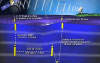
Concept Map: How Does Argo Help Us Better Understand the Global Ocean, and How Do Advanced Argo Floats Help Us Better Understand SPURS?
In Dr. Riser's webinar, he presented a concept map that explored two points – that tools such as Argo floats can help
to provide a better picture of the ocean, and that the combination of new float technology with other tools deployed
in SPURS (such as data from the Aquarius satellite) can contribute to seeing a full picture of the ocean, from "skin
to deep".You can explore the concept map in the window below or save it to your own CLIMB account by clicking on the light blue wrench in the upper left corner and selecting Copy Map to My Maps. To view this map as a PDF, click here (PDF, 135 KB).
This concept map forms the basis of Dr. Risers' presentation. Hover over the concepts to uncover additional resources,
or save this map to your own CLIMB account by clicking on the
light blue wrench in the upper left corner and selecting "Copy Map to My Maps".
Applicable Next Generation Science Standards
Dr. Stephen Riser is a Professor in the School of Oceanography at the University of Washington. His primary interests are in the ocean's role in climate, and in deducing the general circulation of the ocean and ocean/atmosphere/ice interactions through direct observations of the ocean circulation. He is also increasingly thinking about the interactions between physical aspects of the ocean circulation and biogeochemical properties of the ocean.
Snakes on a Ship [NASA Earth Observatory] Dr. Ben Hodges explains what a "salinity snake" is and how it helps to understand salinity processes at the surface of the ocean Measurements by Long-Term Autonomous Platforms in SPURS [NASA Earth Observatory]
Eric Lindstrom talks about the multitude of instrumentation deployed in the SPURS region to understand the near-surface layer of the ocean Managing SPURS Data [NASA Earth Observatory]
Organizing and making sense of the data being generated within the SPURS region is a big task with many players involved!
The Argo Homepage [ARGO] Describes the project and provides links to buoy data - a great place to start looking at the Argo program How To Interpret Argo Profiles [Way Down South]
This website, from an educator in New Zealand, includes many activities and ways to utilize data in a K-12 setting Adopt an Argo Float [Way Down South]
This page describes two ways in which a classroom can "adopt" an Argo float The Scripps Institution of Oceanography Argo Website [SCRIPPS]
An easy-to-use site that brings you directly to the Argo data. Select the view that you want to see and then click on a buoy to reveal its data |


| |
This material is based upon work supported by NASA under NASA Jet Propulsion Laboratory Subcontract No. 1459277. Any opinions,
findings, and conclusions or recommendations expressed in this material are those of the author(s) and do not necessarily
reflect the views of NASA. SPURS Education & Outreach Office School of Marine Sciences, University of Maine Darling Marine Center | 193 Clark's Cove Road | Walpole, Maine 04573 Phone: (207) 563-8176 | Email |