SEARCH OCEAN-CLIMATE SYSTEM
WORKSHOPS
 
Scientist-Educator Collaborative Workshop
Modeling the Ocean-Climate System
Held at the Darling Marine Center in Walpole, ME
Friday, November 22, 2008 through Saturday, November 23, 2008
EVOLUTION OF THE CONCEPT MAP
Click Images to Enlarge
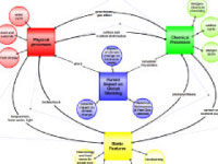
Original concept map created by Fei Chai
Digital concept map created in the COSEE Concept Map Builder
Consensus concept map created using the COSEE-OS Concept Map Builder
Click Buttons for
Presentation Videos & Maps

About this Workshop:
For this workshop, 14 educators from the New England area were matched with ocean and climate scientists from the University of Maine to improve their collective understanding of how the ocean can impact climate change. [more]

About this Scientist:
Fei Chai studies nutrient transport from the interior ocean to the surface by ocean circulation and mixing processes and their impacts on the global carbon cycle. He does this by testing physical-biological models simulating important regions of the oceans (upwelling zones for instance). [more]
Click Images to Learn More About the Educators
Who Worked on this Concept Map
Virginia Brackett
Heather Sinclair
Rebecca Shuman
Fei Chai
 
Scientist Fei Chai explains the concept map and its development:

There are three questions I addressed with my map. 1) How are the climate change/ocean climate models created; and how do scientists use them to predict climate behaviors? 2) Where does data come from? 3) What process or variables do scientists decide to include in those models? On day one of this scientist-educator workshop, I worked with a college student (Jen Graves) and a graduate student (Carrie Armbrecht) to look at these three questions. We started with a few concepts (weather forecasts vs climate predictions, etc.) but if you're an educator in a pre-college school, maybe your students aren't going to be interested in long-term predictions - they just want to know if tomorrow's going to be a snow day!

The modeling process is two-fold, starting with very broad questions: what kind of information do you want and what kind of actions will you take based on that information? In order to generate a forecast you need to have some tools. The model comes from the theory based on background information and observations (theories like Newton's Law and laws of conservation of mass and heat, etc.). Then you identify a set of key processes which you translate into a set of equations containing the variables and parameters of interest. Modellers solve these using computers.

Climate change models are based primarily on three main components: atmosphere, ocean, and terrestrial parts of the earth system. These three system components share and redistribute energy, water, and carbon. Those are the key processes in our climate model. You can run this model for a period over the past, say 50 years, and then compare what the model generates with historical known data. That's the model evaluation - you have to establish credibility of the model. If it works then you can go back to your data and make a forecast for the next 50 years. If the model doesn't hold up then you go back to the theory and the key processes and go through this process again to see what your model is missing. This is a process that modellers repeat in order to keep improving their models.

There is no "perfect model". You can't depend on one single model because there are a lot of uncertainties around initial conditions, different forcings, etc., so you want to depend on multiple models to get a broad envelope of possibilities. You have to know the limitations and uncertainties in your model and then you need to share that with the public. People can then use the model's results to make decisions for the benefit of society.
View All Concept Maps Created at this Workshop
Concept map