SEARCH MODELING RIGHT WHALE MOVEMENT IN THE GULF OF MAINE
WORKSHOPS
 
Faculty/Graduate Student Collaborative Workshop at the DMC
Workshop Theme: Ocean-Climate Connections
Held at the Darling Marine Center in Walpole, ME
Friday, January 29, 2010 and Monday through Tuesday, February 1-2, 2010

EVOLUTION OF THE CONCEPT MAP
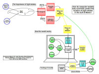
Click Images to Enlarge
Original concept map (left side) created by Andrew Pershing
Original concept map (middle) created by Andrew Pershing
Original concept map (right side) created by Andrew Pershing
Digital concept map created in the COSEE Concept Map Builder
Consensus concept map created using the COSEE-OS Concept Map Builder

About this Workshop:
For this workshop, 15 graduate students from UMaine and 2 post-doctoral researchers were matched with New England-region ocean and climate scientists to improve their collective understanding of Earth's major ocean - climate systems. [more]

About this Scientist:
Andrew Pershing is an ecosystems modeler. The primary focus of his research is to understand what causes the Gulf of Maine ecosystem to change from one year to the next. His work details how alterations in conditions in the Labrador Sea impact plankton communities in the Gulf of Maine which subsequently lead to changes in populations of fish and whales.

As the Gulf of Maine Research Institute's ecosystem modeler, Andy develops computer models that reconstruct and forecast changes in zooplankton in the Gulf of Maine. He currently leads a project that uses satellite data and computer models to predict the location of endangered North Atlantic right whales in the Gulf of Maine. [more]
Click Images to Learn More About the Students
Who Worked on this Concept Map
Marissa McMahan
Maria Nielsdottir
Ashley Young
Andrew Pershing
 
Scientist Andrew Pershing explains the concept map and its development:

My original focus question was "How do models help scientists learn about how right whales move through the Gulf of Maine?" I was trying to weigh two goals I had for my original map: one was to convey exactly how this is done with right whales; but the other was just to introduce the idea of models, how they're used, why they're important, and what a model is. A model is a representation, an approximation of the rules in nature. It's our best guess of how we think the world works, and how we think the parts fit together. In my example of right whales, the model is based on an assumption that right whales follow their food source -- i.e. zooplankton known as copepods -- and therefore we can predict whale locations if we can predict the locations of large populations of copepods. In turn, copepod locations can be predicted by knowing about the conditions that affect them, such as sea surface temperature, chlorophyll as an indicator of phytoplankton, and ocean currents. We use that information to generate "a copepod map" which we then feed into a model for right whales, thus generating a "right whale map". In this first map I was struggling a bit how to graphically represent the idea of this feedback.

When I presented my concept map to the graduate students, I retained both goals of explaining how we use models to locate right whales and also to discuss the general topic of modeling. I went into a fair amount of detail with the graduate students about the specifics of the model's development, the main data sets used to populate the model, "nuts and bolts" about what the model does with data, and the outputs of the models. I discussed the assumptions underlying the models, and also how model outputs can be tested by other scientists who locate and count whales and copepods in the wild.

In collaborating with the post doc/graduate student team, the map's focus question did not change. However, the approach changed in that we chose not to talk as much about models in general but rather to focus more on how this particular right whale model works. The graphic format of the map also changed in that we developed three different sections. One illustrated the ecology of the whale and the importance of the focus question. The second part discussed this particular model and what goes into it. The third part highlighted the process for evaluating the model and improving it, if necessary. In presenting to the high school students the team chose to add some fun things to the map as a way to engage their new audience, for example they added a drawing of a whale and of a computer monitor to illustrate that these are computer models. They also opened the presentation with a video of right whales feeding at sea and prompted the high school students to discover their own knowledge about right whales prior to the presentation.
View All Concept Maps Created at this Workshop
Concept map